The Ahrensperg's castle
From the historical point of view, the Ahrensperg castle is of considerable interest. Heading north, in sight of the fort, there is the castle of Antro, whose historical events are partly linked to Ahrensperg. Both controlled the ancient thoroughfare of Forum Iulii rose towards Noricum, and constituted a real fortification system, together with the nearby castles of Urusbergo and Zuccola (destroyed in the same year) and Gronumbergo, positioned on the opposite bank of the Natisone.
1149
The site is mentioned for the first time
1251
The castle is named as existing from 1251 ( "... quod castrum Ahrensperg debeat pertineri Patriarchae D.")
1274
A document records the conquest from part of Dittmaro Grifenvelse of the Antro castle, and the "Novum apud Ahrensperg" castrum. The attribute has led to think of the existence of a second fort in the village feudal Ahrensperg (third, if you include that of Antro), tried in neighboring locations by scholars but the determination may simply refer to a broad restructuring of the only castle known by that name
1296
Such Camoretto renounced his abitanza in the castle in favor of the Patriarch, which the fief to Volrico Ermanno 1306 The fort was besieged by Count Henry II of Gorizia. The episode fits into the context of the conflict between the Count of Gorizia and the Patriarch Ottobono de 'Razzi, which began in 1305 with a series of hostile actions against the latter, he ended with a truce signed on April 27
1306
The fort was besieged by Count Henry II of Gorizia. The episode fits into the context of the conflict between the Count of Gorizia and the Patriarch Ottobono de 'Razzi, which began in 1305 with a series of hostile actions against the latter, he ended with a ceasefire signed April 27, 1306
1326
November 9, in Udine - Morando Porcia, agent as vicar of the patriarch, appointed Federico Savorgnan and notary Francesco Udine its attorneys to present in front of Henry, King of Bohemia and Poland, to demand the return of Ahrensperg castle (Biacis of Pulfero ) and repair the damage suffered by the church of Aquileia by the Committee of Gorizia
1327
June 20, in Udine - The patriarch Pagano della Torre appointment Odorico of Udine his attorney and notary of Aquileia, to ask prosecutors to Henry, King of Bohemia and Poland, and guardian of the Count of Gorizia, respect the agreed terms, as well as ask the Countess Beatrice of Gorizia the return of the castle Ahrensperg November 13 in Udine - Corrado de Ovenstain and Pietro de Liebenberg promise to the patriarch Pagano della Torre to observe the agreements signed between the Duke of Carinthia and Gorizia committee and the patriarch and the church of Aquileia; Peter, upon receipt of the patriarch letters, promises to deliver the castle Ahrensperg (Biacis of Pulfero) to Bernard of Strassoldo
1364
The castle was demolished. The same year were demolished castles neighbors Zuccola, Urusbergo, and Antro. In the framework of the disputes that countered the Lodovico Patriarch of the Tower and its allies (including Francesco di Carrara and the Emperor and Louis, King of Hungary) to the Duke of Austria Rodolfo, in his time ally with some families in Friuli, including the Zuccola- Spilimbergo. He survived the destruction of the square tower, still visible today
1365
The Parliament of 3 April decreed, among other things, that the destroyed castles were not 2 be rebuilt, and this decision probably also involved the Ahrensperg castle. The castle was never rebuilt, and the segments of the walls were used as building material
1511
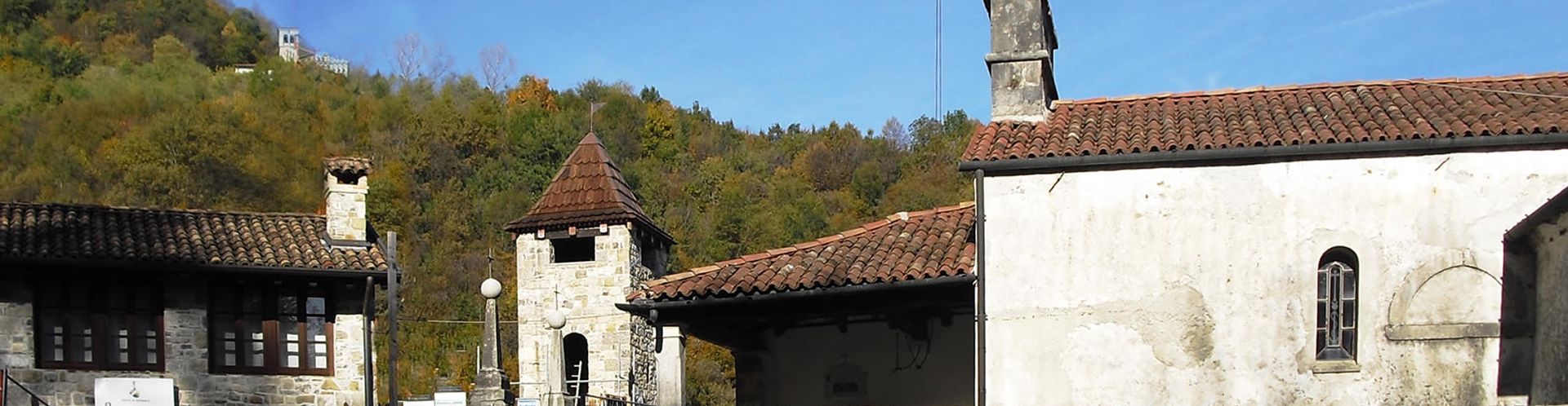
the castle site was built the church of SS. James and Anna The castle area continued to be visited even after the destruction, the fact that at the church gathered the Vicinia of Biacis and the Bank of Antro and that the tower survived the destruction was used as a prison
1567
The first description of the factual situation of the vestiges is provided by Girolamo di Porcia who in 1567 wrote: "below the plane (compared to Antro) are the vestiges of an ancient ruined castle, where is still a tower piece used by the Slaves instead of prison "in reference to sanctions imposed by the Bank
1900
In the early 1900s Michael Leicht he described the ruins, characterized by the presence of a tower: "... Codest keep results from a pentagon glue straight base of 21 meters, a bevel angle of five meters, another face of the mountain six meters and two sides of 10 meters each. The current walls emerge slightly from the ground and measure a thickness of a meter. The middle of the forehead to the hill country and outside it still raises a square tower of 4 meters per side fourteen meters high and no door formed by walls of dressed stone with a thickness of one meter. In the courtyard of the keep, leaning to the middle of the length of the wall of 10 meters, you can see the ruins of the walls of a square tower of 4 meters by 5 meters high from the ground no more than 3 meters and also the remains of an 'other tower of the same size that emerges just above the ground "
1909
The tower is declared of significant interest on the basis of Article. 5 of the Law of 20 June 1909, n. 364 (Notification of 27/10/1927)
1927
The tower visible in the high was restored in 1927, as stated by an inscription on the tower itself. In the same period they were made of the site development works by Italcementi
1974
The Nicoletti Koenig and architects as well describe the situation in a survey: boundary tracks towards the North-East, to the north tower ... ruins of agricultural houses built probably on the foundations and remains of two towers "
1978
Tito Miotti writes: Walking up the narrow street that leads to the church Biacis, just before this there are leftovers, covered with shrubs, a round tower "; He mentions of "an 'other tower that was located about twenty meters from the church to the west and of which there is only a pile of rubble" "Among such cumulation and the church are the remains of a building: the walls are not thick, about 40 cm., and the sides appear irregular. As built with stones similar to those of the ancient fortress, it could be later work "; It mentions an almost square tower (mt. 3.10 x 3.40) with a thickness of 80 cm and height about 8 mt. vertical slits in each side; an input missing. "Parallel to the walls of the church runs a large wall mt. One that wraps around a semi-circle the church and the area that runs alongside it until the main tower ... straight sections of contemporary masonry work continues in an east-west getting lost in the woods ... "
2003-2006
Begin archaeological investigations of the castle site by three excavation campaigns: in August 2003, in the winter of 2005, in June-July 2006, in June-July 2009 in June-July 2010. Taken together these interventions have unearthed the following structures: • in front of the church have been identified two walls in the direction NE-SW and EW; the latter continues for 16 m along the southern side of the church • boundary walls have been identified on the W side of the church (the facade) • other walls were highlighted along the N side of the church, and believed, like the previous, relevant to fortress. In particular, a north-south trend wall has a thickness of about 80 cm and is made with the technique "lots," that is to say with the external and internal facings made with hewn stones and arranged in regular rows, and 3 internal filling made up of mortar, stones and smaller stones, a construction technique particularly in use in the low-middle ages; the wall continues north for a total of 10 meters. The northernmost point, at a strain, still remained in situ 6 rows of the internal hangings; Furthermore the excavations have unearthed relevant architectural structures to a building consisting of three built environments with building materials coming from the castle, on indeterminable, and in use until at least the nineteenth century, a similar bill to the rustic visible elevation.
2007-2008
First consolidation of the emerging structures through the reconstruction of the architectural volume of the country this elevation composed of two overlapping circles constructed with building materials coming from the castle, on indeterminable, and in use until at least the nineteenth century with the partial support of the Province of Udine.
2009-2010
Continue the archaeological investigations. The stratigraphic excavation of the area has allowed initially to highlight substantial portions of the walls collapsed in place and relevant to a part of the building located N of the church of SS. James and Anna, presumably structured on several levels, of whom was later identified on the basement level of a square shape (9,00 x 10,00 m) at an altitude of about 3.00 m below the present ground level. The building was partly visible only limit W, oriented NS, and the access threshold with four semicircular steps developed into E. The excavation is later emerged the perimeter D and E made up of blocks of squared stone bound together by lime, willing on a single facing leaning against the bench of rock dug artificially to create the basement. The last stages of henna looking forward bringing to light the perimeter N, highly uneven, tempered at a much lower altitude than other perimeter and set directly on natural rock bench. This is very well only preserves the angular NE, constituted by massive stone blocks for a thickness of 0.80 to 0.90 m. Material evidence emerged during the excavation in 2009 and 2010, although still under investigation campaigns, allow, after a first analysis, to recognize a pretty consistent timeline with historical information about the Ahrensperg castle. The artefacts found in previous layers to the collapse of the structures seem to be able to frame between the thirteenth and fourteenth century, then in the years preceding the documented destruction of 1364. However, it was also possible to recognize a phase of subsequent attendance to the collapse of the structures, as witnessed by the presence of pottery the late-sixteenth and the partial reuse of some fragments of the walls collapsed.
2010
The parish of San Silvestro of Antro Pope, with the partial support of the Region Friuli Venezia Giulia Regional Law n. 60/1976, consolidates and reassembles the wall surrounding the castle church of SS. Giacomo and Anna.
2011
Recomposition of the architectural and restoration of almost square tower remaining volume (mt. 3.10 x 3.40) with a thickness of 80 cm, with the partial contribution of the Region FVG lr. n. 10/2000.
2012
Prime consolidation operations with building material from the castle collapses of substantial portions of the walls collapsed in place and relevant to a part of the building structured on several levels, presumably the keep, through the reconstruction of the architectural volume.